Open-Source GIS Consultancy · Slovakia

We turn geodata
into decisions
that matter.

Two PhDs. World Bank experience. Fifteen years of spatial intelligence for governments, regions, NGOs and communities across Central Europe.

🌍
🗺️
🤝
🌱
👥
🔓
100% Open
QGIS · OSM

Spatial intelligence
across every scale

From a single municipality mapping their infrastructure to a World Bank-assisted national SDI rollout — we speak the language of place, data and impact.

🏗️
Spatial Data Infrastructure

Design, deploy and operationalize SDI for regions and municipalities. We build working geopservices from scratch, aligned with INSPIRE standards and open data principles.

🌍
GIS Consulting & Analysis

Deep spatial analysis for environmental, social and regional challenges — from vulnerability assessments to land-use planning.

🗺️
Geo-product Development

Designing and publishing ready-to-use geo-products: map layers, spatial datasets, interactive atlases and open-data packages tailored for public administration, research and the private sector.

🤝
Community & Humanitarian Mapping

Participatory mapping with real communities. Mapathons, OpenStreetMap integration and field data collection with Mergin Maps.

📚
Training & Capacity Building

QGIS workshops, university curricula, teacher guides and field training — making spatial thinking accessible to governments, professionals and students.

📊
Data Storytelling & Visualisation

Thematic maps, dashboards and visual narratives for reports and public communication — making complex geodata genuinely understandable.

Products & Solutions

Scalable geospatial products for public sector and local governments, built on open-source foundations.

🌐 Open regional geoportal · Live prototype
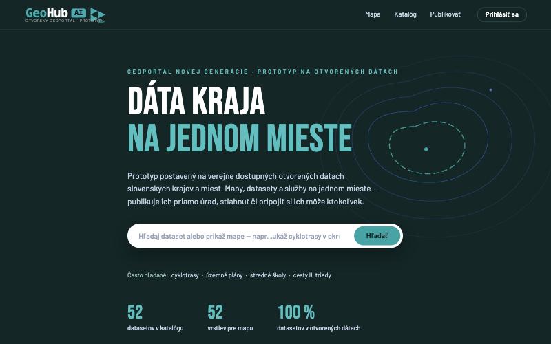
GeoHub AI

A lightweight spatial data infrastructure with an AI layer: a region's or city's data in one place, published by the departments themselves and open to anyone.

  • Map viewer and data catalogue with natural-language search
  • “Emil”, the AI guide: type a sentence and the map assembles itself
  • Open interfaces and export to QGIS and ArcGIS, styles included
  • Open data automatically (DCAT-AP), no manual work
GeoHub AI – live open geoportal prototype
📊 Project monitoring · Demo for cities
CityWatch

An information system for monitoring a city's EU- and state-funded projects: projects on a map, indicators, drawdown by fund and implementation status reports on a single dashboard.

  • Dashboard: number of projects, average progress, projects that need action
  • Map and database of projects filtered by fund and status
  • Status reports from implementers, cross-checked against the national ITMS2014+ system
  • Key indicators: target vs. actual, drawdown of ERDF, ESF+, CF and JTF
Core Pain
Project status lives in spreadsheets, e-mails and people's heads
Outcome
One panel for the city leadership
Format
Web application + reporting
Model
B2G · cities
🗺️ Managed GeoOps · Geodata city
GeoOps

From static maps towards live geodata city. A service for cities and municipalities that want to truly use spatial data in everyday decision-making.

  • GeoData Audit Score — inventory of data, systems and responsibilities
  • Field-to-Map Workflow — field data collection and regular updates
  • GeoOps Dashboard — freshness, coverage and backlog tracking
  • Monthly GeoOps Report and managed support
Core Pain
Data ages and gets domain-locked
Outcome
Live geodata workflow
Format
Audit + Ops + Model
Model
B2G · GovTech · Citizen
🏔️ B2G GIS Platform · INTERREG Central Europe
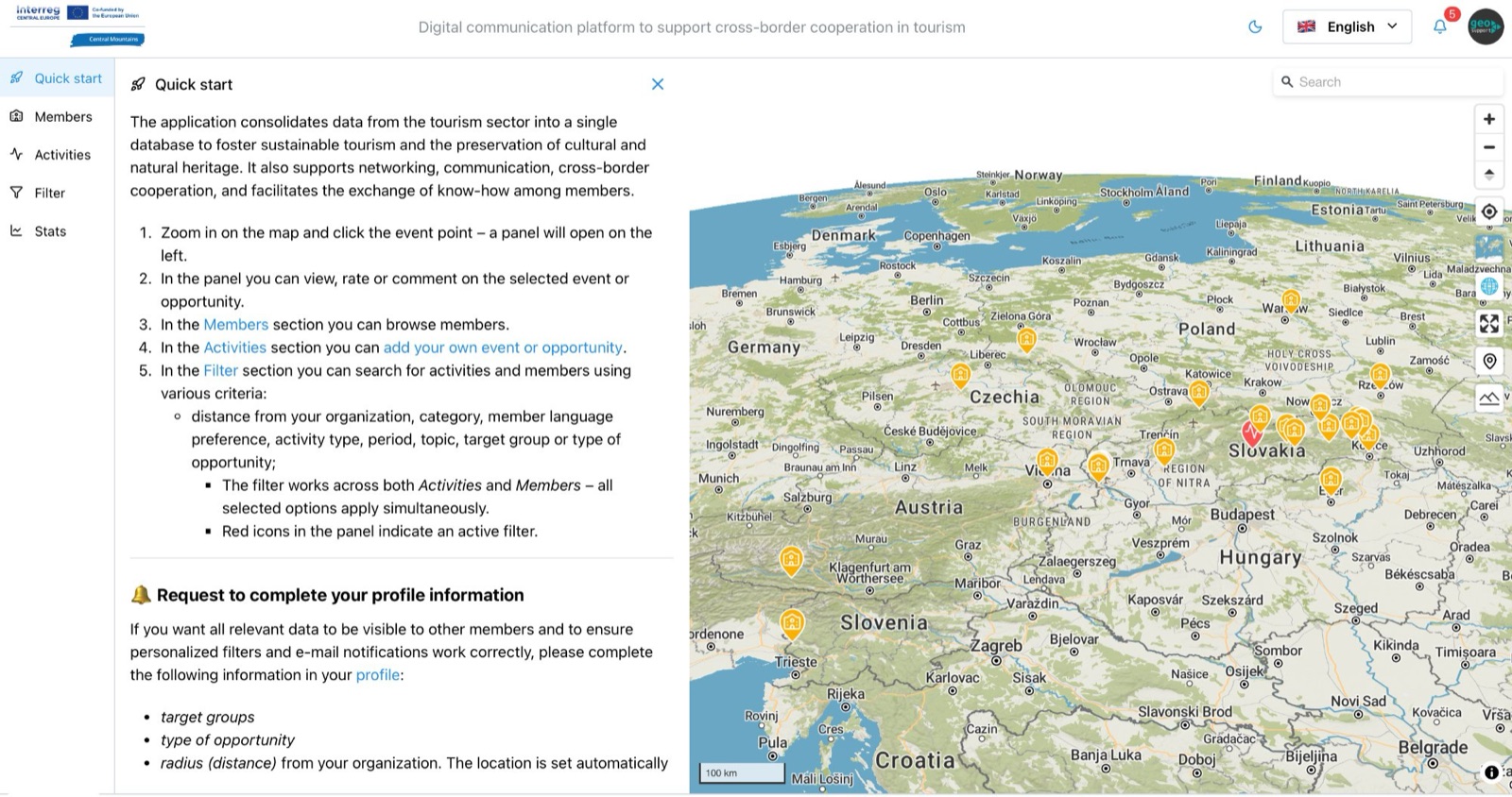
Central Mountains

A B2G GIS web application that puts every mountain tourism stakeholder on a shared map across 7 Central European countries.

  • Member registration and activity mapping by category and time
  • Cross-border filtering and real-time messaging
  • Open geospatial core — no vendor lock-in
  • 11 partners from 7 countries · ZMOS · 2023–2026
Central Mountains GIS platform
More products coming soon  ·  Stay tuned

Real projects.
Measurable impact.

We don't just deliver files — we build infrastructure that lasts and knowledge that stays.

From zero GIS unit to a regional open data infrastructure — in one year

Prešov Self-Governing Region & World Bank Group · 2018–2024

The Prešov Region — one of the poorest in the EU — had no functioning GIS unit when we started. Miloslav led the spatial data component of the World Bank Catching-Up Regions Initiative: building the geoportal from scratch, training staff and establishing INSPIRE-aligned data governance across the whole region.

50+architects, planners and civil servants trained in QGIS and open spatial data workflows
3Slovak regions now operating geoportals built on open-source SDI
Read the World Bank report →More about the project →
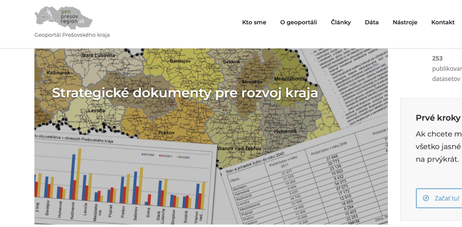
Regional district map produced as part of the Prešov Region SDI project
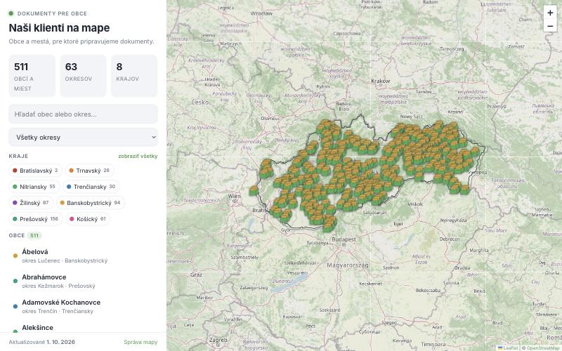
Interactive client map for Dokumenty pre obce

An interactive client map the company updates itself

Dokumenty pre obce · 500+ municipalities · 2026

A company preparing documents for more than 500 Slovak municipalities needed a reference map it could maintain without a developer. We built a lightweight web map with an admin panel: a colleague types the name of a municipality, the national register fills in the district, region and coordinates, and the public map is up to date immediately. The whole dataset can be downloaded back at any time as CSV, Excel or GeoJSON.

511municipalities on the map at launch
2 884Slovak municipalities in the register for automatic completion
0developer interventions – the company adds municipalities itself, backups are automatic
Open the live map →More about the project →
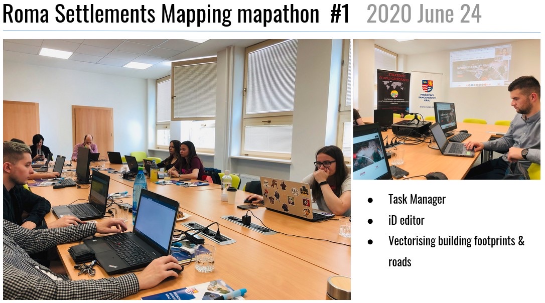
Roma Settlements Mapping Mapathon #1 — June 24, 2020, Prešov Region

First Missing Maps mapathon in the Prešov Region — making invisible communities visible

Prešov Self-Governing Region · World Bank · University of Prešov · 2020

In 2020, we organised the first ever Missing Maps mapathon at the Prešov Region offices — a landmark event mapping marginalized Roma settlements that had never appeared in any official dataset. Working with geography students and experts from Prešov University, our team conducted field surveys in six pilot municipalities, digitizing building footprints and conditions directly into OpenStreetMap.

6municipalities field-surveyed: Čičava, Dlhé Stráže, Krivany, Ostrovany, Varadka, Varhaňovce
Read the project story →Scientific paper (Springer) →More about the project →
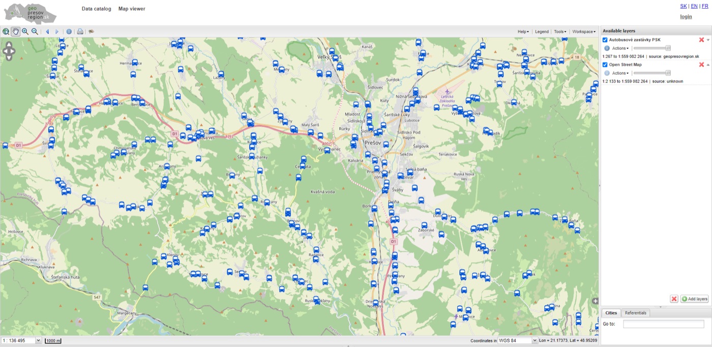
Autobusové zastávky PSK — live view in geopresovregion.sk geoportal

From field to database: inventorying public infrastructure across the Prešov Region

Prešov Self-Governing Region · 2020–2022

Using QGIS and Mergin Maps, we designed and deployed end-to-end field data collection workflows for the Prešov Region — capturing suburban bus stops with schedules and accessibility data, outdoor advertising structures, bridge conditions and building registries. GPS-accurate records collected on mobile devices flowed directly into the regional geospatial database, ready for analysis and planning.

Read about the bus stop project →More about the project →

Open-source GIS literacy for government: 50+ planners and civil servants trained

Prešov Self-Governing Region & Ministry of Investments SR · 2019–2024

We designed and delivered a multi-year QGIS training programme for the Prešov Region — turning civil servants, architects and urban planners into confident GIS practitioners. Courses covered open data workflows, spatial analysis, geoportal use and field data collection. The curriculum was later adapted as a national reference for other Slovak regions seeking to build their own GIS capacity.

50+government professionals trained across multiple workshop series
Read about the training programme →More about the project →

50+ financial data visualisations for a US media company — in an official partnership

HowMuch.net — Washington, US · 2017–2020

From 2017, Geosupport became an official Data Visualization, Data Analysis and Data Science partner of HowMuch.net — a US-based financial intelligence media platform. Under a signed cooperation agreement, we produced over 50 economic maps and infographics including state-by-state analyses of US trade, income, taxes, real estate and GDP. Several visualisations were picked up and republished by international media.

50+economic maps and infographics produced for international media distribution
Visit HowMuch.net →More about the project →

Slovakia hosts the global QGIS Conference — 240 participants, 50 talks, 30+ countries

Slovak QGIS User Group · Bratislava, 2024

Jana, as President of the Slovak QGIS User Group, co-organised the 2024 QGIS User Conference in Bratislava — the flagship annual gathering of the world's largest open-source GIS community. Hosting the conference in Slovakia raised the international profile of the region's open GIS ecosystem and brought global contributors to Central Europe.

See the conference →More about the project →

Teaching the next generation to map their world — the EUthmappers Handbook

Erasmus+ European Commission · 2021–2023

Jana and Miloslav co-edited the EUthmappers Handbook — a freely available guide for high school teachers to integrate open geospatial tools including QGIS and OpenStreetMap into STEAM education. Published under Erasmus+, it is used across European classrooms and serves as a bridge between geographic education and civic digital literacy.

Read the handbook →More about the project →

Trust built through
real work.

From World Bank technical notes to signed cooperation agreements — our track record speaks for itself.

Two PhDs, one engineer.
One shared mission.

Jana and Miloslav Michalko are the core of Geosupport — a husband-and-wife team with decades of field experience, supported by expert developer Martin Ždila.

A clear path from
data to decision

Direct, transparent and always focused on outcomes — not deliverables for their own sake.

Three ways to
engage Geosupport

Whether you need expert input, a full project delivery or to grow your team's skills — we have an engagement model that fits.

Open-source first,
always.

Free, auditable and community-driven. No vendor lock-in. No proprietary black boxes.

Let's work together

Your data has a story.
Let's find it.

Whether you're a municipality, NGO, regional authority or international organisation — we're ready to help you use spatial data better. All starts with a free 30-minute call.