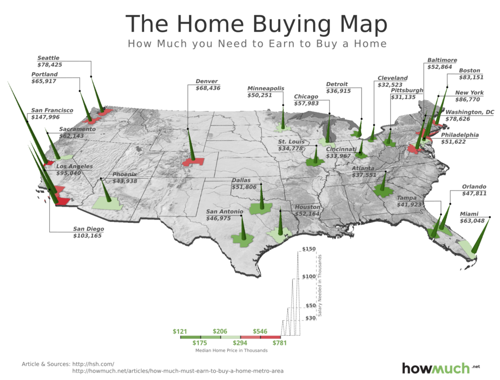
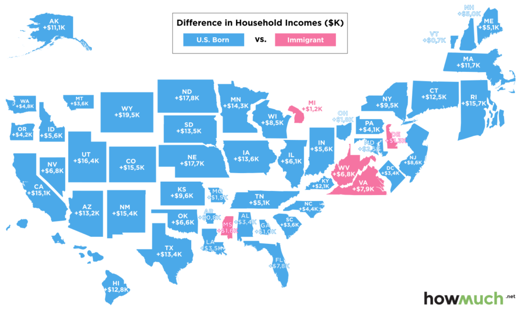
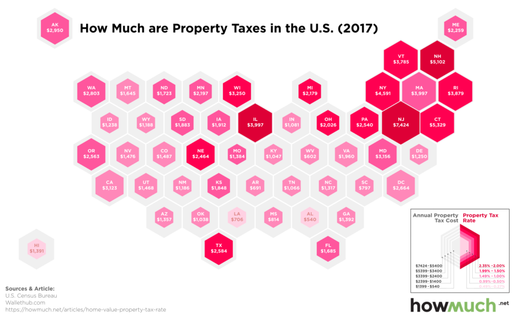
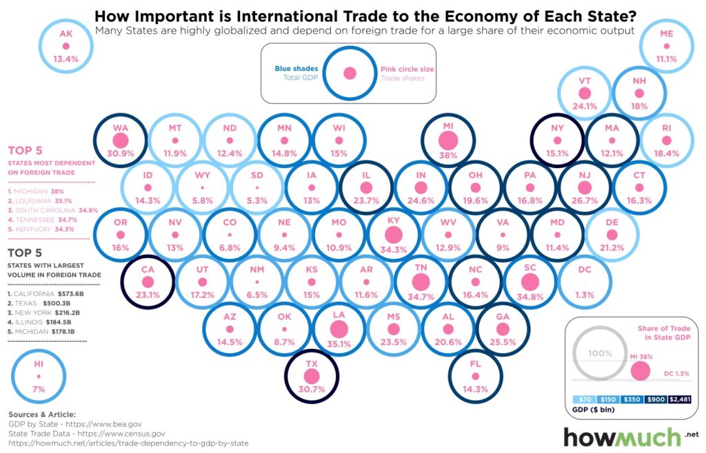
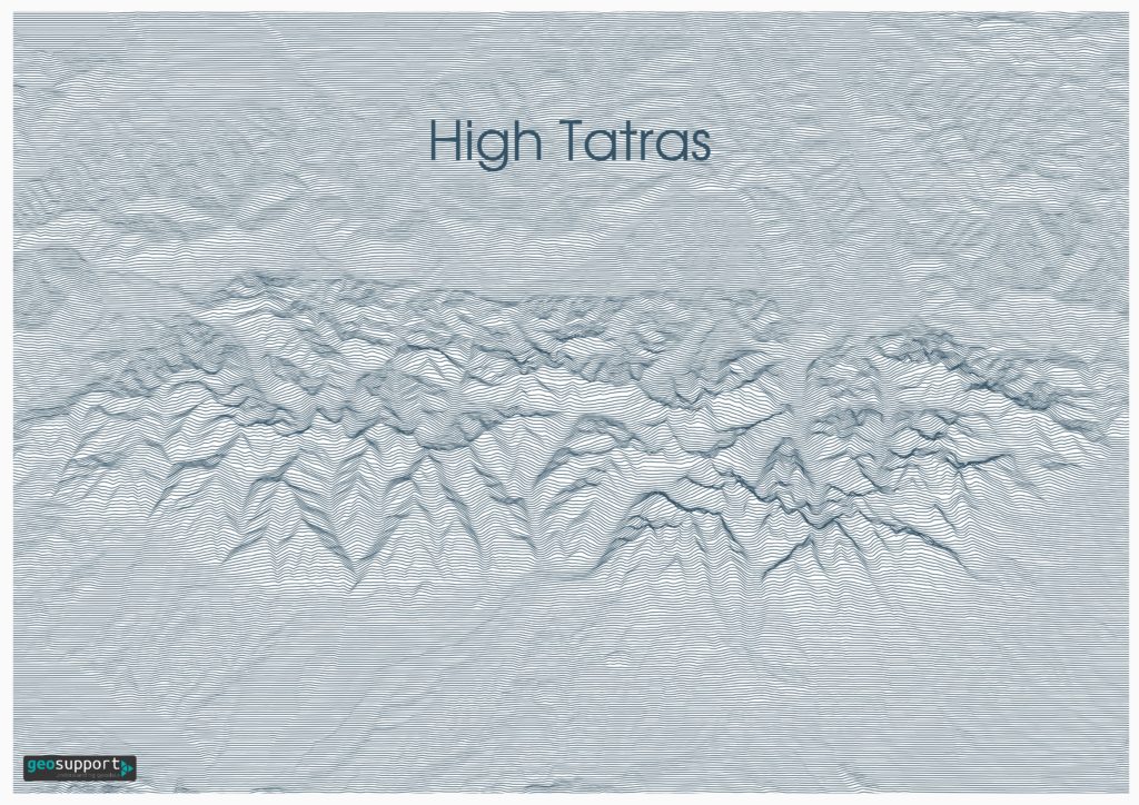
Geovisualization or geovisualisation (short for geographic visualization), also known as cartographic visualization, refers to a set of tools and techniques supporting the analysis of geospatial data through the use of interactive visualization. Like the related fields of scientific visualization and information visualization geovisualization emphasizes knowledge construction over knowledge storage or information transmission. To do this, geovisualization communicates geospatial information in ways that, when combined with human understanding, allow for data exploration and decision-making processes. Traditional, static maps have a limited exploratory capability; the graphical representations are inextricably linked to the geographical information beneath. GIS and geovisualization allow for more interactive maps; including the ability to explore different layers of the map, to zoom in or out, and to change the visual appearance of the map, usually on a computer display. Geovisualization represents a set of cartographic technologies and practices that take advantage of the ability of modern microprocessors to render changes to a map in real time, allowing users to adjust the mapped data on the fly. (https://en.wikipedia.org/wiki/Geovisualization)
