Products & Solutions
Open-source geospatial products for regions, cities and municipalities: geoportal, project monitoring, managed geodata.
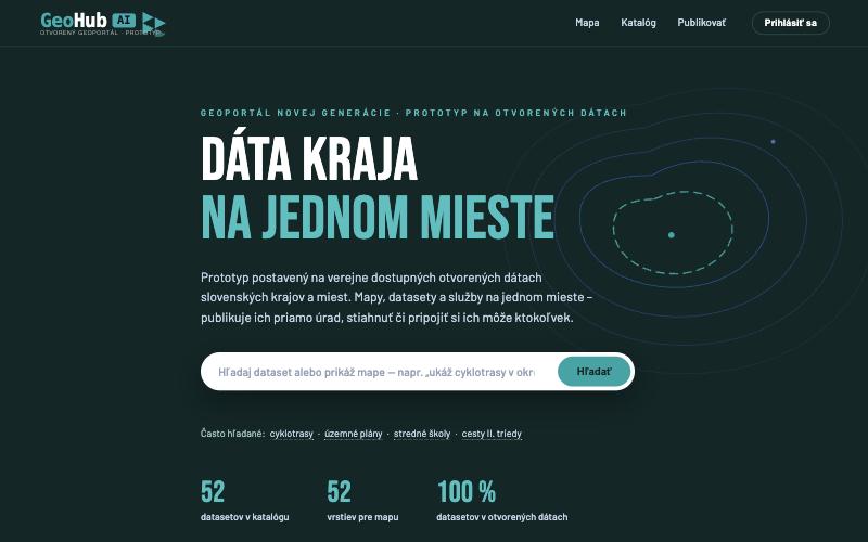
Open regional geoportal · Live prototype
GeoHub AI
A lightweight spatial data infrastructure with an AI layer: a region's or city's data in one place, published by the departments themselves and open to anyone.
- Map viewer and data catalogue with natural-language search
- “Emil”, the AI guide: type a sentence and the map assembles itself
- Open interfaces and export to QGIS and ArcGIS, styles included
- Open data automatically (DCAT-AP), no manual work
Project monitoring · Demo for cities
CityWatch
An information system for monitoring a city's EU- and state-funded projects: projects on a map, indicators, drawdown by fund and implementation status reports on a single dashboard.
- Dashboard: number of projects, average progress, projects that need action
- Map and database of projects filtered by fund and status
- Status reports from implementers, cross-checked against the national ITMS2014+ system
- Key indicators: target vs. actual, drawdown of ERDF, ESF+, CF and JTF
Core Pain
Project status lives in spreadsheets, e-mails and people's heads
Outcome
One panel for the city leadership
Format
Web application + reporting
Model
B2G · cities
Managed GeoOps · Geodata city
GeoOps
From static maps towards live geodata city. A service for cities and municipalities that want to truly use spatial data in everyday decision-making.
- GeoData Audit Score — inventory of data, systems and responsibilities
- Field-to-Map Workflow — field data collection and regular updates
- GeoOps Dashboard — freshness, coverage and backlog tracking
- Monthly GeoOps Report and managed support
Core Pain
Data ages and gets domain-locked
Outcome
Live geodata workflow
Format
Audit + Ops + Model
Model
B2G · GovTech · Citizen
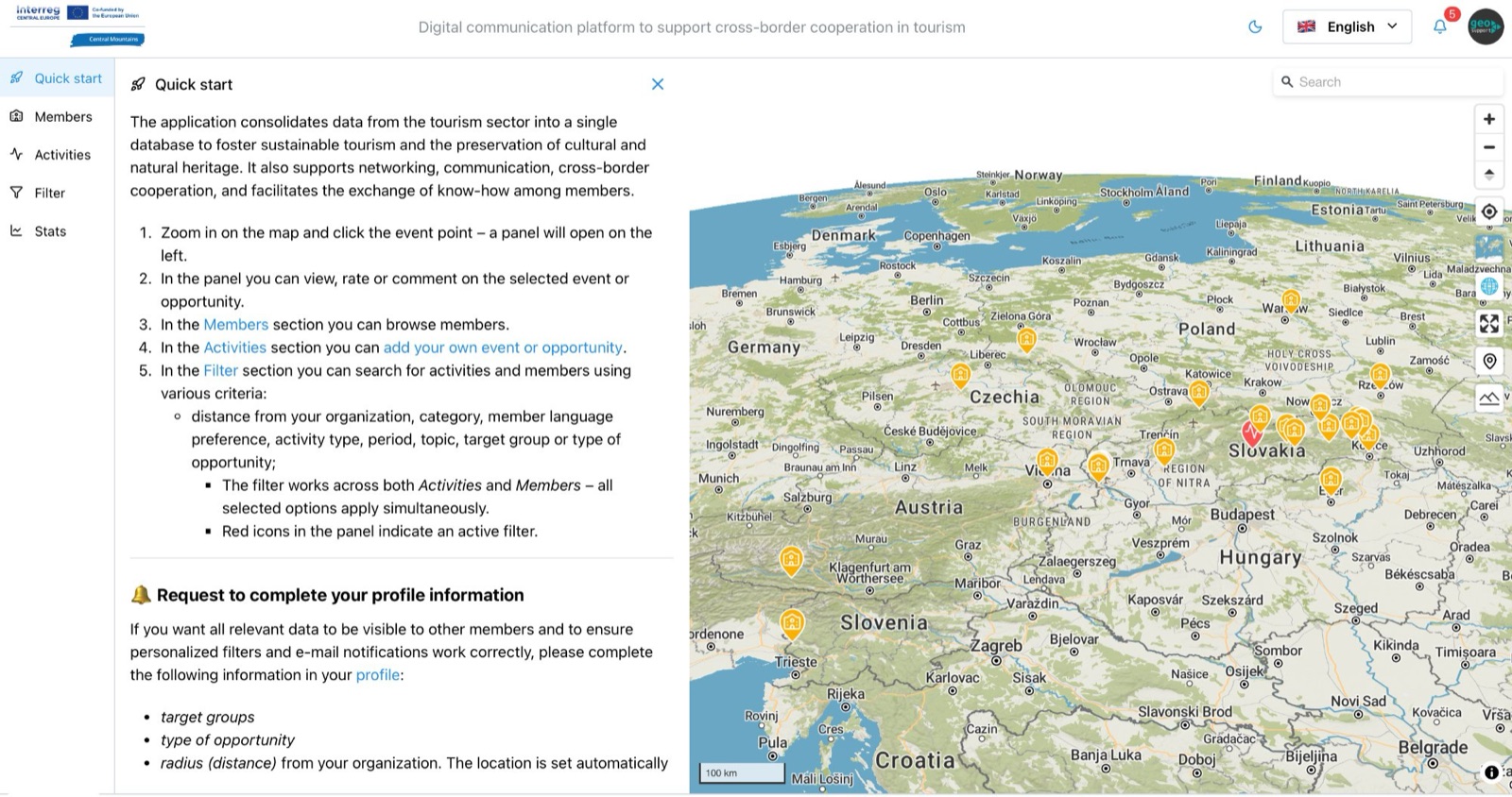
B2G GIS Platform · INTERREG Central Europe
Central Mountains
A B2G GIS web application that puts every mountain tourism stakeholder on a shared map across 7 Central European countries.
- Member registration and activity mapping by category and time
- Cross-border filtering and real-time messaging
- Open geospatial core — no vendor lock-in
- 11 partners from 7 countries · ZMOS · 2023–2026
More products coming soon · Stay tuned